
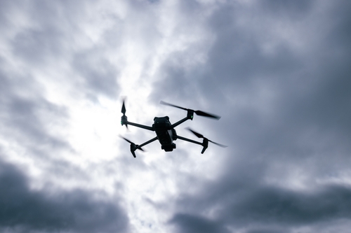
Calamities can happen at any time. They put everything at risk—people, buildings, you name it. Drones, or unmanned aerial vehicles (UAVs), are changing things for the better though.
Take the 2015 Nepal earthquake, for instance. UAVs were used for search and rescue, mapping, and strategizing relief efforts. Fast-forward to 2023, the University of Maryland has developed an innovative drone system that can detect signals from mobile devices. This means they can find people who need help way faster. Over in Japan, they’re not taking any chances with their frequent earthquakes and typhoons. They’re using drones to check out their infrastructure and give emergency teams a hand. Even NASA has joined the fray, launching the Scalable Traffic Management for Emergency Response Operations (STEReO) project that focuses on using UAVs for such tasks. Just what makes these aerial gadgets tick?
When Faced With Mother Nature’s Fury
Earthquakes, hurricanes, floods, or wildfires leave a trail of devastation in their wake. Cleaning up afterward is a massive task for the affected communities. Let’s look at the numbers: In the first half of 2023 alone, natural disasters caused a staggering $110 billion in global losses. And out of that, around $43 billion was covered by insurance. Did you know tropical cyclones are some of the deadliest, with over 800 thousand lives lost since 1980? They also account for over 50% of the total associated costs, amounting to $1.36 trillion over the period.
Each disaster comes with its own set of challenges. Earthquakes demolish buildings and disrupt roadways. Hurricanes and floods result in widespread water damage and expose residents to a plethora of health risks. Wildfires decimate vast land areas. The common thread in all these scenarios is the urgent need for efficient recovery and remediation efforts—and UAVs have proven to be an asset.
For instance, in response to the derecho that struck the Midwest U.S. in August 2020, the NOAA National Severe Storms Laboratory used drones to collect detailed images and videos of rural areas in central Iowa to estimate storm intensity and associated hazards. On the other hand, the drones used as part of NASA’s STEReO project track firefighters and drop forest fire retardant at a safe distance during wildfires.
Benefits Of Using Drones During Natural Disasters
Here are reasons why disaster response drones are in heavy demand:
Rapid Deployment
Say a hurricane has just swept through a coastal town. Instead of waiting for roads to clear, a drone is sent up immediately. This prompt response is crucial for timely decision-making and rescue operations, offering an expedited way to gauge the impact.
Enhanced Safety
Drones enable assessments to be conducted from a safe distance, especially in situations with hazardous conditions. Think of a collapsed building after an earthquake. Instead of risking lives by sending people into potentially unstable rubble, a drone flies over, checking out the scene and relaying real-time feedback—keeping our brave rescue teams out of harm’s way while gathering essential data.
Access to Inaccessible Areas
In cases where areas are cut off due to floods or other obstructions, emergency drones come in handy. They can easily navigate these hard-to-reach locations and waterlogged areas, ensuring that the assessment is thorough and no critical spots are missed. For instance, after Hurricane Delta hit Louisiana, NOAA and the Northern Gulf Institute used drones to collect imagery of the Mississippi Riverbanks to assess the flooding impact caused by the hurricane.
Comprehensive Coverage
Drones provide aerial views that give a more complete picture of the extent of damage, particularly useful in widespread disaster zones like wildfire-affected regions. From the ground, it’s tough to see the full extent of the scorched land. But from above, a drone captures it all, showing us just how far the damage stretches. This perspective is essential for understanding the full scope of the situation.
High-Quality Data Collection
Equipped with advanced imaging technologies, drones are capable of capturing high-resolution images and videos. This level of detail is crucial for accurately assessing the condition of infrastructure and affected areas—especially with integrated software that provides all stakeholders with real-time footage.
Cloud-based drone operations management software have proven beneficial for high-res, low-latency live streaming, as well data analysis and storage. There are even cases where you can create 2.5D base maps for terrain awareness and 360-degree panoramas and live annotations for rapid aerial awareness and coordination.
ALSO WATCH: FMA Shorts: How Can Natural Disasters Impact Facilities Managers and Businesses?
Firefighters, paramedics, and search and rescue teams, NGOs coordinating humanitarian aid, all through to local and federal agencies together with the urban planners and engineers tasked with repairs and rebuilding can collaborate more smoothly. Moreover, the visual documentation serves as a record for insurance and aid purposes, streamlining the claims process.
The data is invaluable for architects, engineers, and planners, providing a precise base for renovation plans. By analyzing drone imagery, teams can identify which structures are salvageable and which need demolition, ensuring efficient resource allocation.
They provide topographical data and geospatial information that is crucial for understanding the landscape’s new reality post-disaster. This information is pivotal for redesigning infrastructure, rerouting utilities, and planning new construction in a way that mitigates future disaster risks.
You get this with mapping software, capturing RGB, thermal, or multispectral images, then transform them into digital spatial models and maps. Software with photogrammetry capabilities can generate 3D maps and models from images, even getting to sub-centimeter accuracy. Moreover, you can use it to measure distances, areas, and volumes, and share data among team members for further collaboration.
Cost-Effectiveness
Compared to traditional methods, drone assessments are often more economical. They offer a faster, wider range of data collection—compared to covering all that ground with teams on foot or in vehicles, or dispatching helicopters to each area.
Drones don’t work in isolation. Their effectiveness is enhanced when integrated with other technologies. The footage obtained can be analyzed with artificial intelligence (AI) algorithms to identify damage and predict failures. Then, there’s geographic information systems (GIS) software that analyzes spatial data from drones, to be used in subsequent planning. Building information modeling (BIM) tools use drone data to create interactive 3D models of buildings. This is really handy for virtual tours and planning renovations without having to actually be there. And thanks to cloud computing, relevant stakeholders who need access can check out this data from anywhere, anytime. This synergy of drones and tech is paving the way for a more resilient and efficient approach to disaster recovery—and we’re eager to see what the future holds.
Maurice Mugo is a digital content producer at DSLR Pros, a dealer of commercial drones and enterprise UAV solutions.